Tropical Storm Eta

This is a screenshot of the live radar on the WKMG Channel 6 Pin Point Weather app. As of this writing, this is where the storm is.

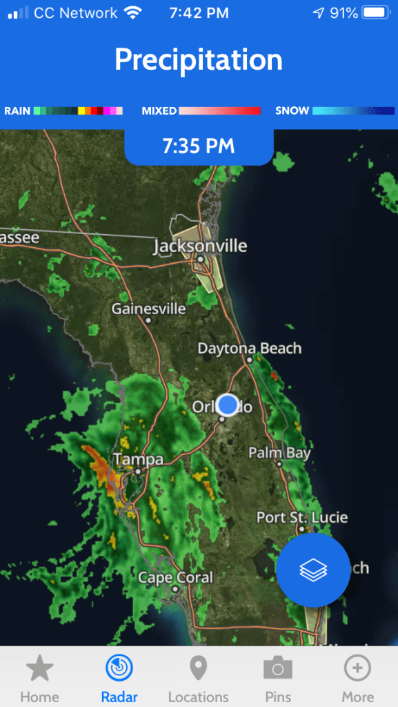
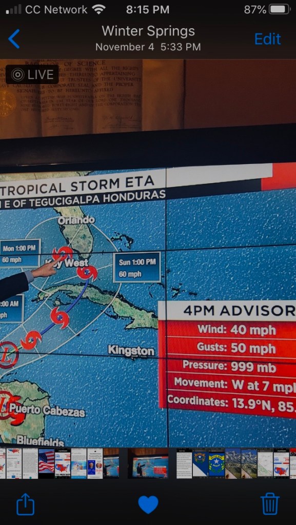
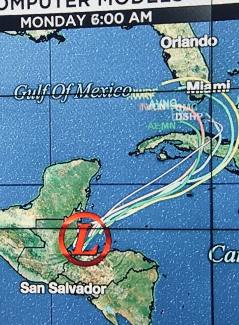
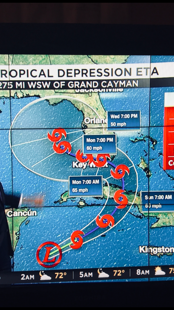
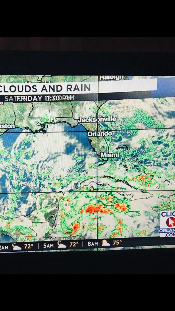
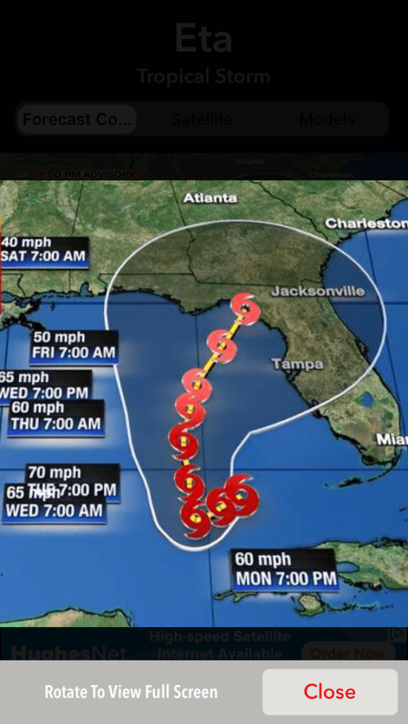
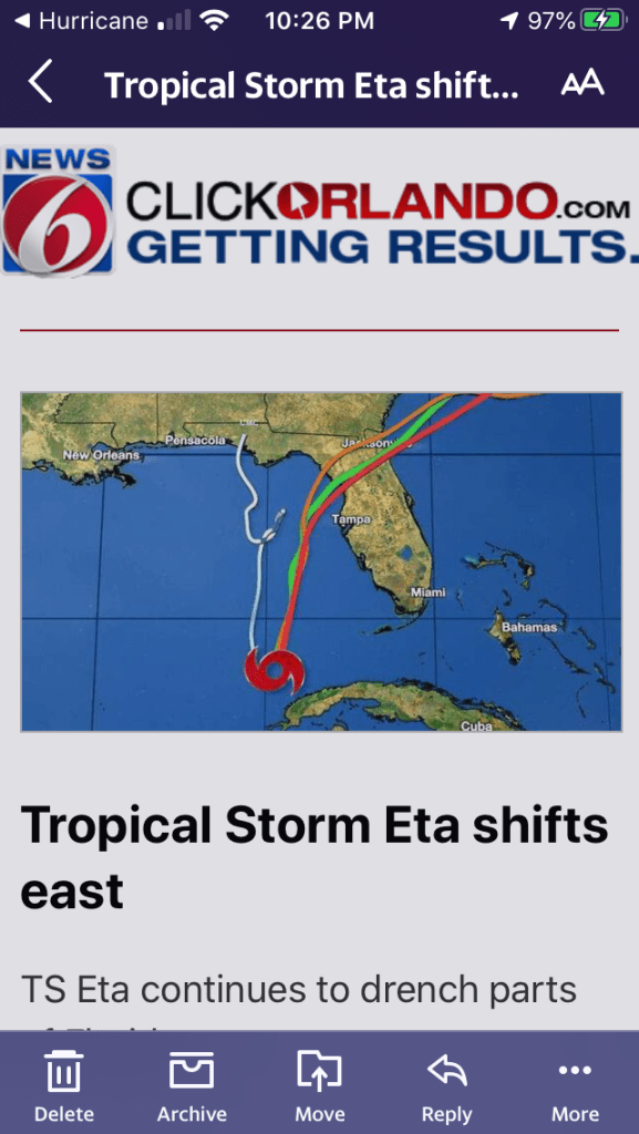
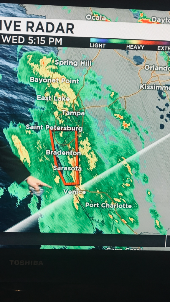
This storm has been a strange one. It was going to hit Florida and then not and late afternoon yesterday it veered East. Now, it’s right off the West Coast of the peninsula.

This was last week when the storm was nearing Honduras and was thought to curl back and head toward Florida.
Some early spaghetti models.
Another early projection from last week.
The mess that was Eta last week.
On Monday the trajectory left Florida almost entirely in the clear.
The rain pounding my windshield as I was waiting at red light at the intersection next to the Walmart parking lot. This was Monday 11/9/2020 as I left work around 5:45 pm ET.
This is rain being pushed our way the same day that Eta was deemed to not hit Florida.
Spaghetti models that came out Tuesday afternoon.
Screenshot from the WKMG Channel 6 Hurricane tracker app. I took this last night-Tuesday 11/9/2020.
Also last night. I’ve lived in both Tampa and Port Charlotte, which is about two hours south of Tampa, between Sarasota and Ft. Myers.
Also last night.
This is this afternoon at 4:30 pm ET. Rain band from Eta. Screenshot from the WKMG Channel 6 Pin Point Weather app.
Closer to home. Same radar as image above this one.
One county over-northeast of Seminole County. Volusia is right on the Atlantic Ocean. It’s where Daytona Beach is located. This flooding in Volusia started last night.
Eta rocking a boat in the Gulf off the coast in Lee County, near Ft. Myers.
The location of Eta as of 5:15 pm ET today 11/11/2020. WKMG Channel 6 Orlando.
The location of Eta just before I hit the, “Publish,” button on my WordPress app. This is a screenshot from the WKMG Channel 6 Pin Point Weather app.

Leave a comment

This site uses Akismet to reduce spam. Learn how your comment data is processed.